A Hierarchical Component-Based WebGIS and Its Key Technologies
keywords: Component, WebGIS, hierarchical model, geo-union, spatial cache, spatial index
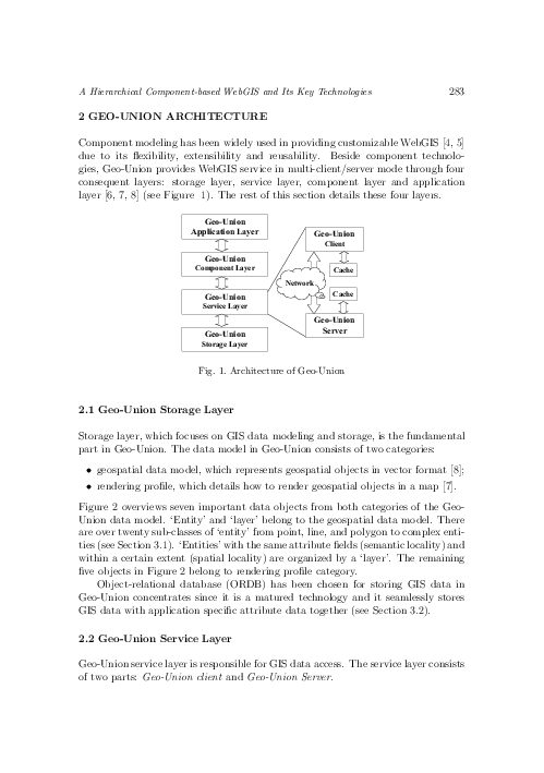
A practical hierarchical component-based WebGIS model referred to as Geo-Union is presented. Geo-Union consists of four layers: storage layer, service layer, component layer and application layer. Service layer is partitioned into another two layers: Geo-Union client and Geo-Union server. The architectures and object diagram of each layer in Geo-Union are discussed in details. After that, four key technologies adopted in Geo-Union (spatial data model, ORDB, spatial index and spatial cache) are summarized and analyzed, especially the spatial cache framework of Geo-Union. At last, some future works in WebGIS, such as interoperability, security, distributed computing and intelligent computing, are indicated and simply explored.
reference: Vol. 24, 2005, No. 3, pp. 281–296